home of ukraine photosHOME
about project and photographerABOUT US
ukraine photoPHOTOS OF UKRAINE
PHOTOMAPS OF UKRAINEPHOTOMAPS OF UKRAINE
articles about ukraineTEXTS
our service of photo saleSERVICES
contacts with usCONTACTS
ukraine photos, travel in ukraine
Google
 
Web www.photoukraine.com

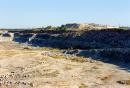
Ukraine photos by region > Ivano-Frankivsk Region > Chornohora. Measuring the height of the lower edge of the clouds

Name: Chornohora. Measuring the height of the lower edge of the clouds
Location: Ivano-Frankivsk Region

Chornohora. Measuring the height of the lower edge of the clouds Ivano-Frankivsk Region Ukraine photos


You can buy (reasonable price) any photo images (needed printing quality) from site

You can order any interested in Ukraine photo image by e-mail [email protected], and if one is in extensive photo archive, it will be publishing on the sight especially for you

You can order any interested original photo image from any place of the Ukraine by e-mail [email protected], and after payment will receive one during three days

Berdiansk. Monument to A. Pushkin and lights, Zaporizhzhia Region, Monuments
Uzhanskyi Reserve. Top Dividing Range, Zakarpattia Region, National Natural Parks
Vorokhta. Peter and Paul Church and memorial cross, Ivano-Frankivsk Region, Churches


weather forecast Kiev map of Kiev city
2004-2024 © Andrey Ivchenko
Support by pikalov.kiev.ua